As a fan of geography and cartography I present you some scans of old maps from inter war era Latvia and Soviet era. These maps are interesting in many aspects. How the political borders changed throughout the century, how the place names and their spelling changed and various other things that changed over times. These maps are from my collection.

Maps from the School Geographical Atlas sixth edition by E. Y. Petrin. St. Petetersburg A.F. Marks publishing 1914.
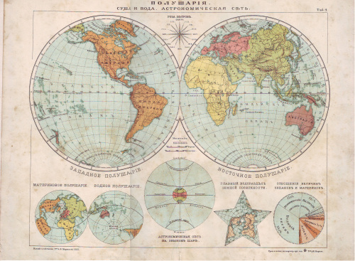
World map
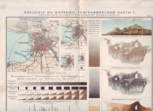
Map of St Petersburg and geographical shapes
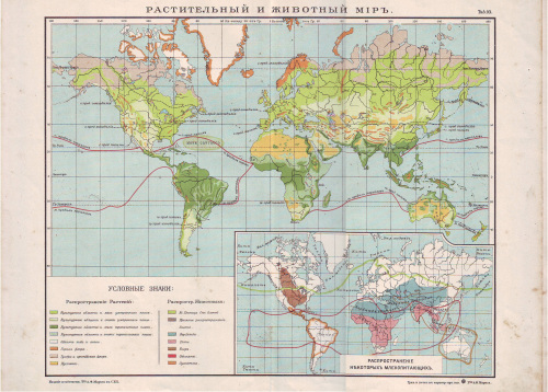
Map of global fauna
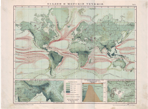
Global humidity map and the sea stream routes
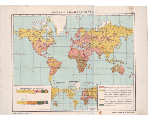
Nations and ethnicities of the world. There are four nation types: European type, Mongolian Type, Negro type and Midgets
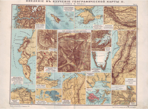
Examples of the geographical shapes and types. Penisulas, islands, mountain ranges and river deltas
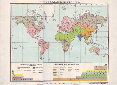
World Religions
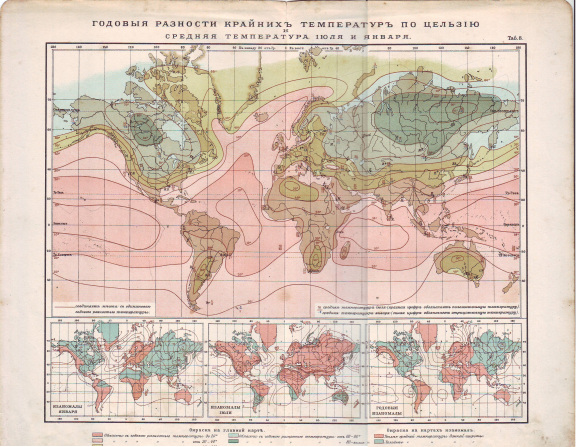
Global temperatures. Average temperature on January and July
Part of the Western Russia map showing Baltic provinces. Presumably the original owner has drawn the German attack route trough Kauna (Kovno) towards Riga on 1915.
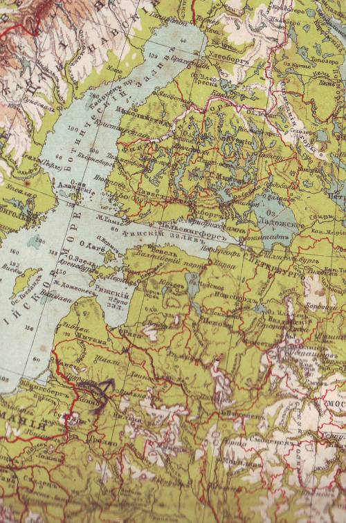
Northern part of European (Western) Russia
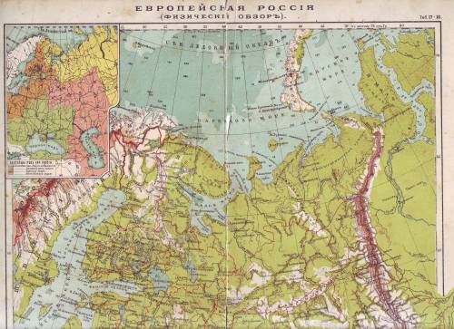
Eastern part of the European Russia – Ural mountain regions
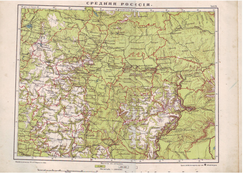
Central Russia- Moscow and surrounding areas
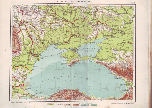
Southern Russia- Ukraine, Crimea and Western Caucasus
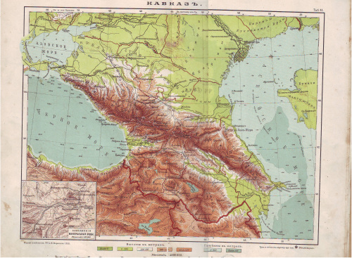
Caucasus
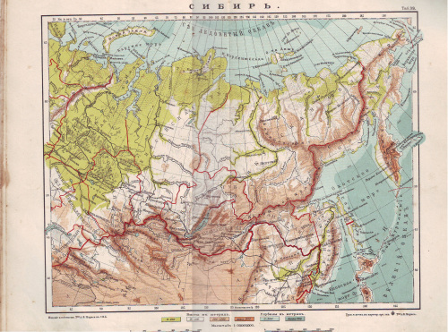
Siberia
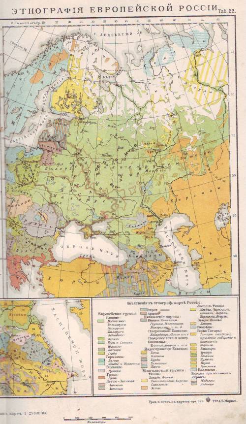
Ethnic groups in Russian empire. Slavs are shown as green. Ukrainians are labeled “Malorossi” – Lesser Russians. Latvians and Estonians share land with Germans. Map features the Jewish Pale of Settlement.
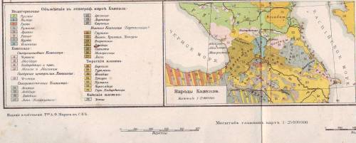
Ethnic groups in Caucasus
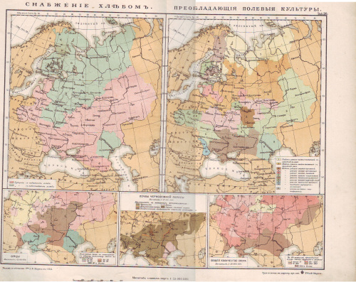
Bread distribution and agricultural cultures in Western Russia
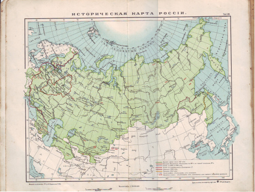
Historical map of Russian empire. Showing the expansion of Russian empire showing dates of conquering. Also showing temporary acquisitions during Russian-Japanese war on 1905
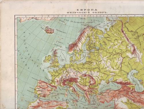
Physical map of Europe
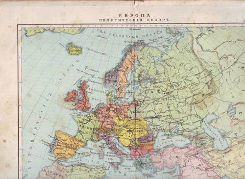
Political map of Europe. 1914 borders.
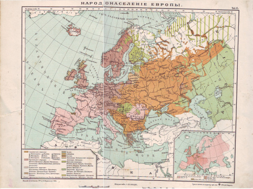
Ethnic groups in Europe
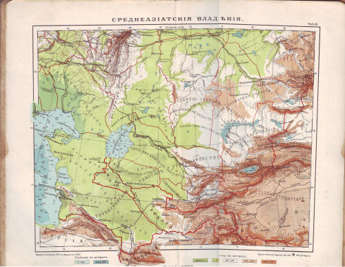
Central Asian provinces
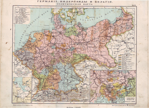
German Empire and Benelux States. Political divisions of the German empire.
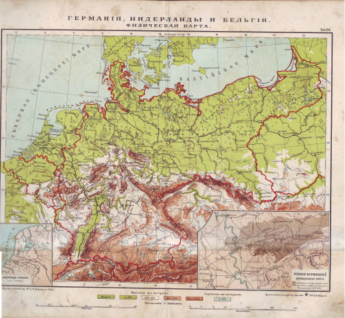
Physical map of Germany and Benelux states
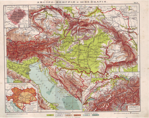
Austria-Hungary. Also showing percentage of Slavs in Moravia
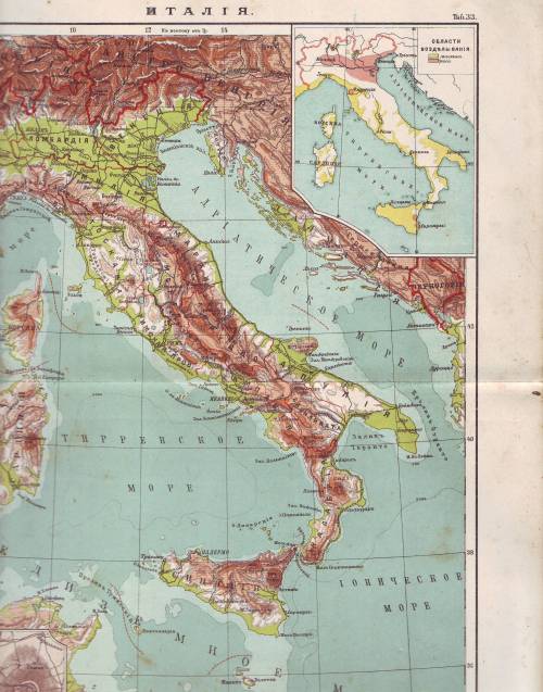
Italy
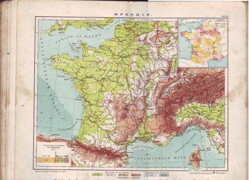
France
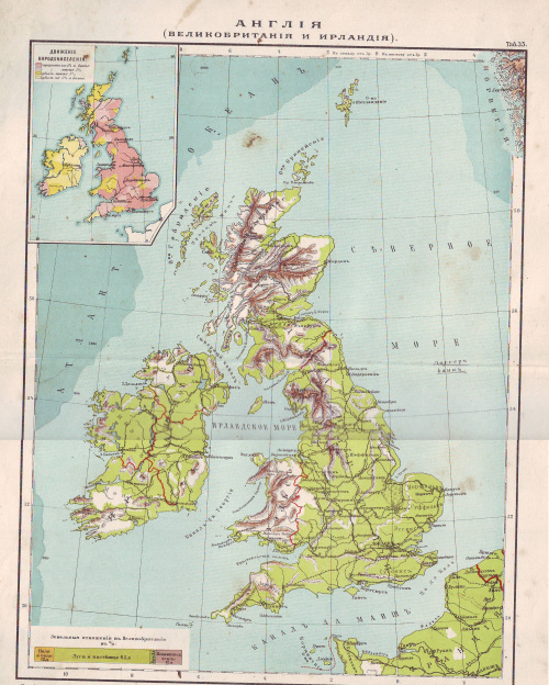
England (Great Britain and Ireland
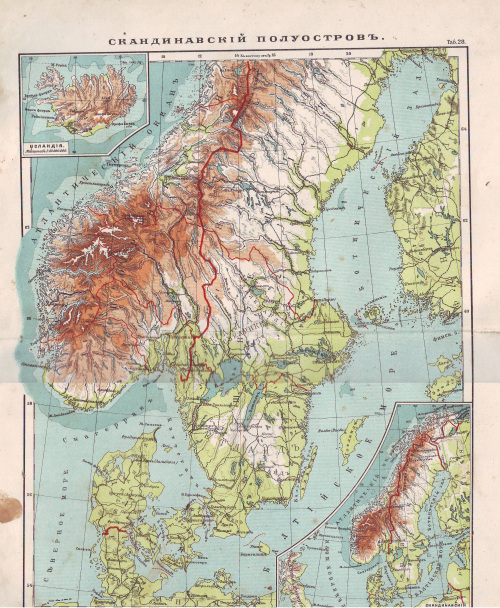
Scandinavia
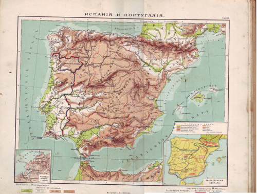
Spain and Portugal
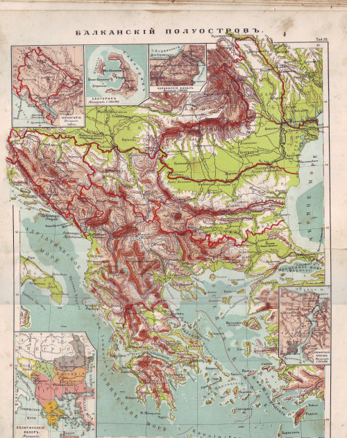
Balkan countries
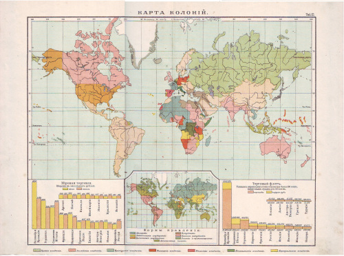
Map of colonies according to 1914 political situation, trade and forms of government
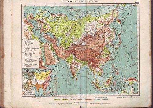
Asia. Physical map
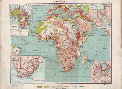
Africa
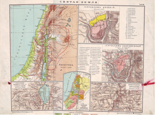
Map of Holy Land. Map of Ancient Israeli tribes. Map of Ancient and 1914 era Jerusalem
Map of Europe by Freytag & Bernt 1920
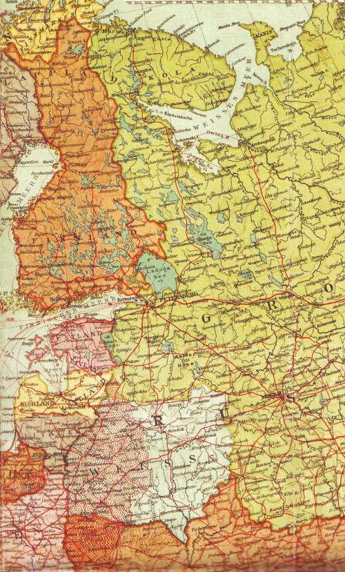
Fragment of the map showing new Baltic republics and Belarusian People’s Republic. Note the purported Belarusian state includes Latgale, eastern part of Latvia as her territory. Latgale is also shown as territory in dispute for Poland.
Maps from the P. Matnieks Extended Geography Atlas. 193oies
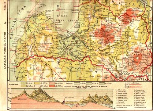
The geographical map of Latvia. Also showing the highest points in the country.
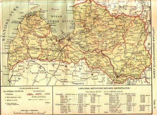
The administrative map of Latvia showing main regions and districts
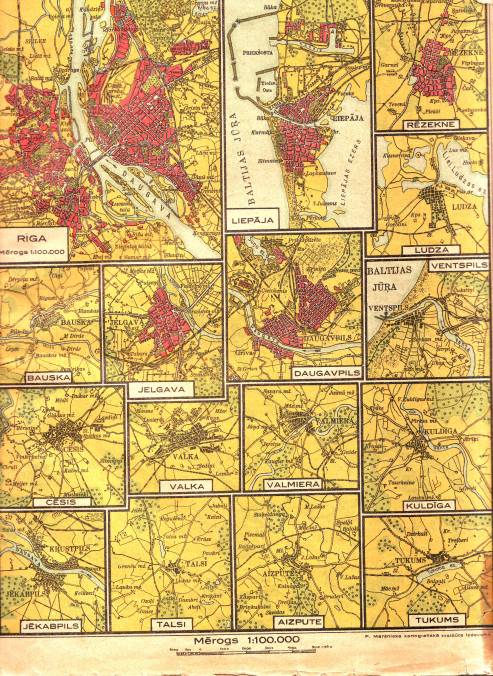
Maps of various cities in Latvia
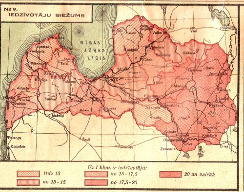
The population density in Latvia
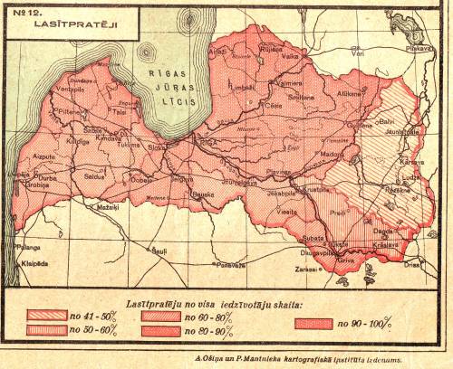
The percent of literacy
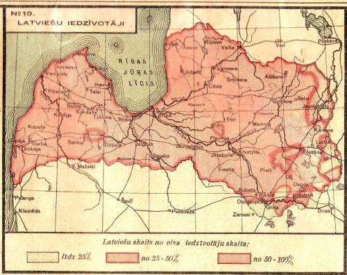
The number of ethnic Latvians
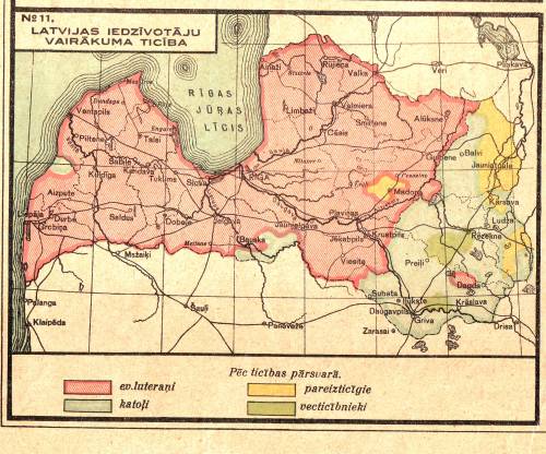
Main faiths in Latvia
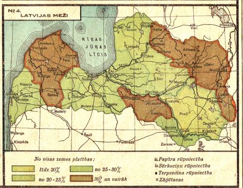
The density of the forests in Latvia
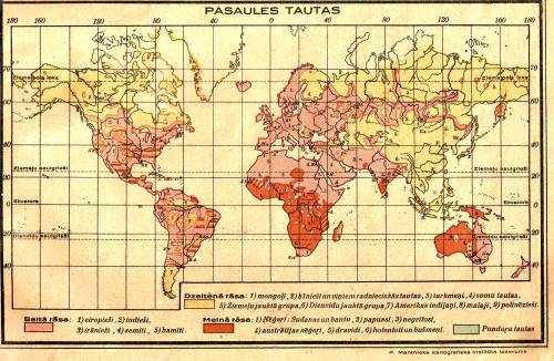
Map of the ethnic groups and races. 1. The White Race (pink) – Europeans, Indians, Iranians, Semites, Hamites. The Yellow Race (Yellow) – Mongolians, Chinese and their related people, Turkmenians, Finnish people,mixed Northern Group,Southern Northern Group, American Indians, Malaysians, Polynesians. The Black Race (brown) Negroes: Sudanese and Bantu, Papua, negritos, Australian Negroes, Dravidians, Hottentots and Bushmen. Green is for “Midget people”
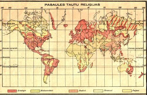
Worlds religions, Christians (purple), Muhammadan (green), Buddhist (red), Brahman (light green) and Pagans (yellow)
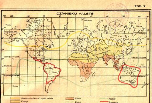
Animal kingdom map showing inhabited areas of steers, camels, elephants, tigers, monkeys and marsupial
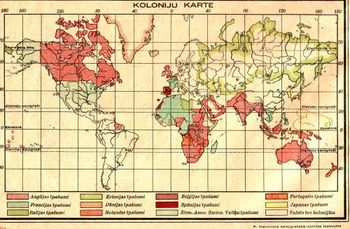
Colonial map showing possessions of England, France, Italy, Russia, Denmark, Holland, Belgium,Spain, Northern American United States, Portugal and Japan. Country names translated according to the originals
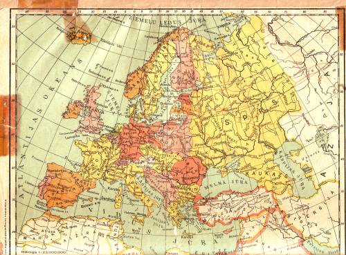
Political map of Europe
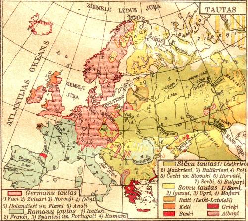
European ethnic nations
Nations are grouped in Slavs (green), Finnish peoples (yellow), Baltic peoples, Celts, Basques, Greeks, Albanians, Germanic people and the Romanic people
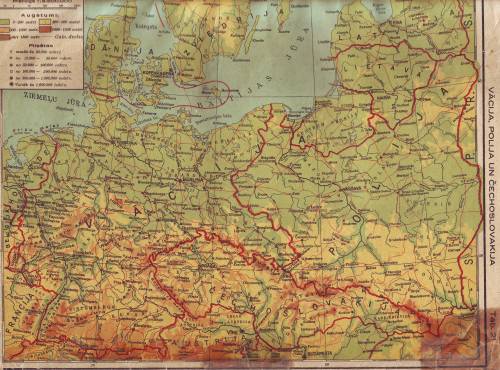
Germany, Czechoslovakia and Poland. Pre 1939 borders
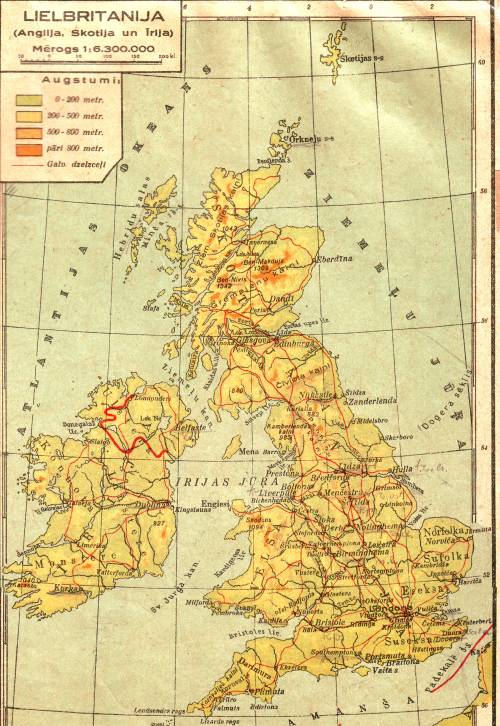
Great Britain and Ireland
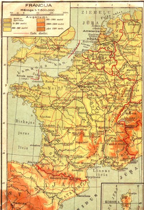
France
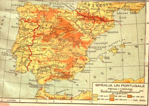
Portugal and Spain. Note the Catalonia is shown apart from Spain with ts own border
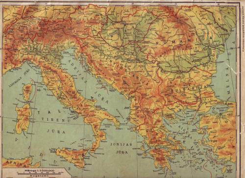
Italy and the Balkans. Romanian pre 1939 borders
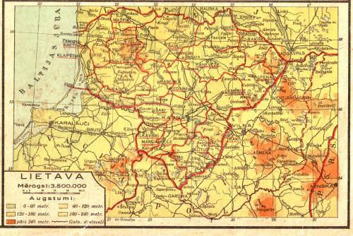
Lithuania with her pre 1939 borders
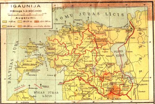
Estonia with pre 1944 borders
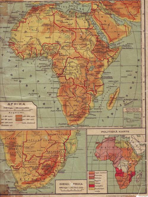
The colonial Africa and the Southern Africa in detail
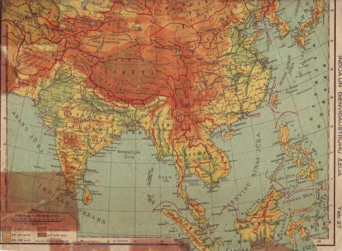
India and China. Note the independent Tibet and its borders
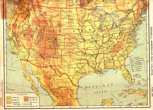
The North American United States as they are called in this map of USA
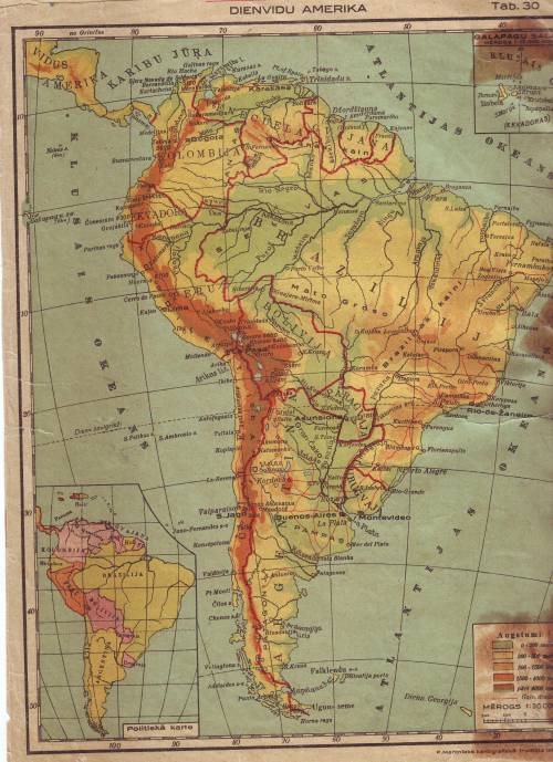
South America. Note the pre Chaco War Bolivian – Paraguayan borders
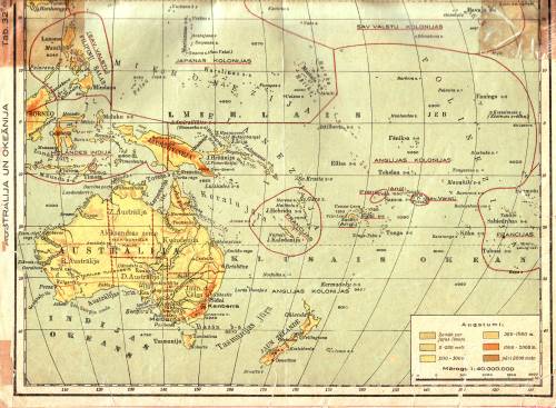
Australia and Oceania
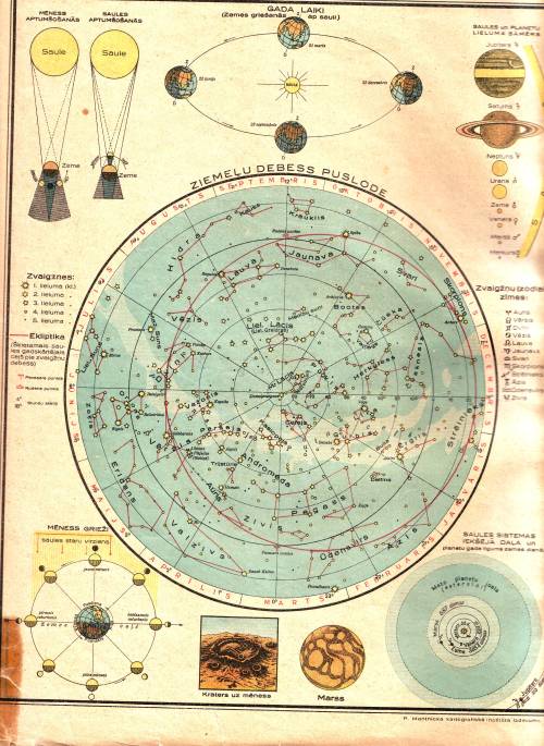
The Cosmographic chart showing zodiac map, size of the planets. Also shows the Mars “channels” a popular misconception of those times
Latvian Road Map 1940. The Latvian Transportation Department
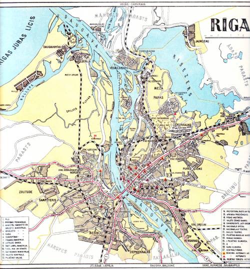
Riga 1940
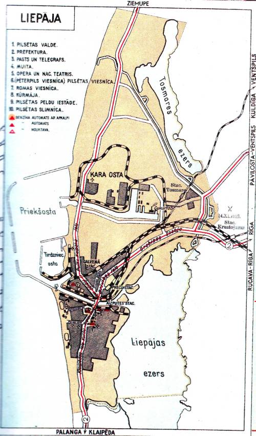
Liepāja 1940
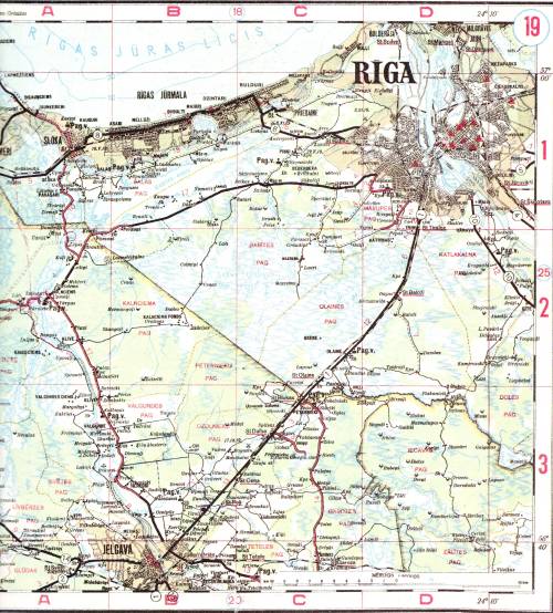
The western outskirts of Riga
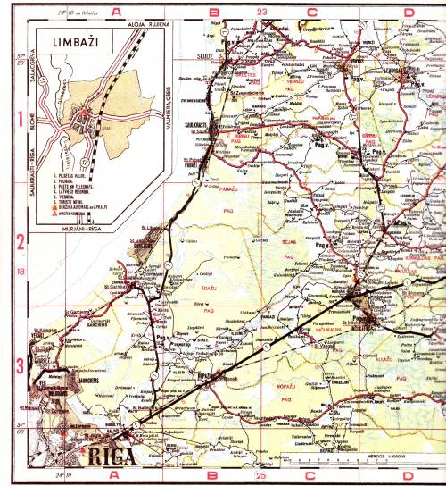
The North East Outskirts of Riga
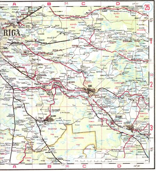
The Southern outskirts of Riga
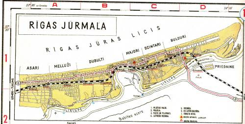
The city of Jurmala or Rigas Jurmala as it was called then. Ķemeri and Sloka were separate cities in 1940.
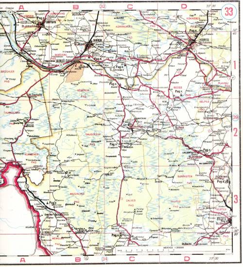
Jaunjelgva region and Koknese. Note the natural river Daugava route before building the hydro electric dams
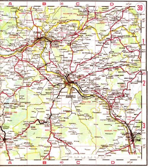
Jekapbils and Pļaviņas. Krustpils was separate city from Jēkabppils til 1962
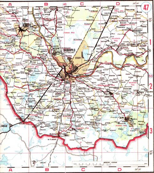
Daugavpils and Ilūkste
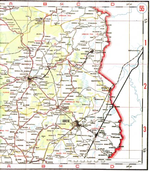
The city of Abrene annexed by Russia on 1944
Geographical atlas for High school 5-6th grade. The Main Department of Geodesics and Cartography of the Soviet Ministry of Interior Affairs. 1958. Moscow
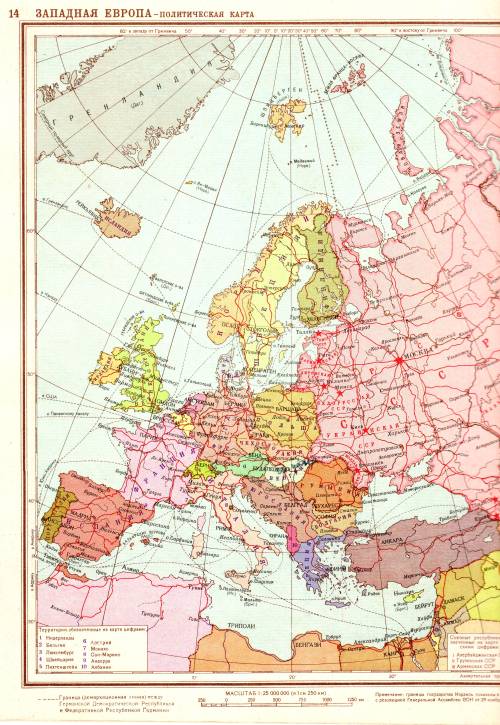
Western Europe 1956 borders
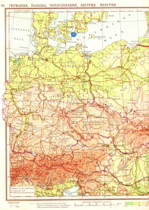
Germany 1956, without outlined borders between GFR and GDR
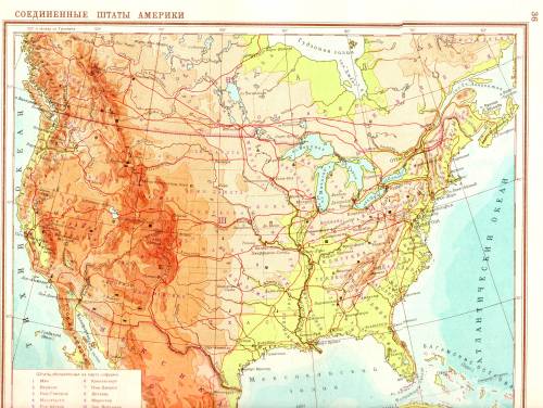
1956 USA
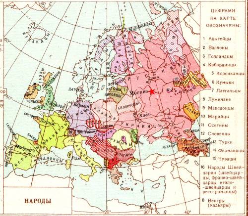
1956 map of the European ethic groups. Note number 7 – Latgalians
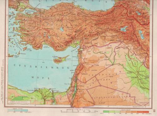
Map of the Middle East 1956
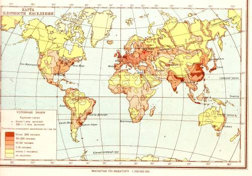
Worlds Population density 1956
Atlas from unknown publisher 1960ies era Latvia
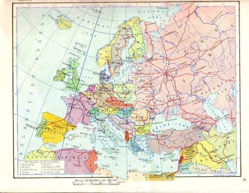
Europe in 1960
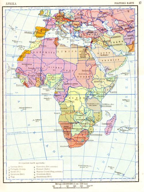
Europe in 1960, decolonization ongoing
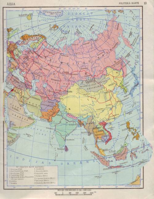
Asia in 1960
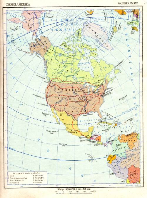
North America 1960
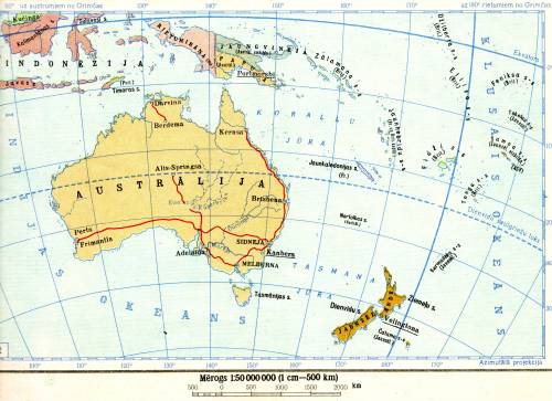
Australia 1960
1960 Latvian SSR Geodesic and Cartography main department
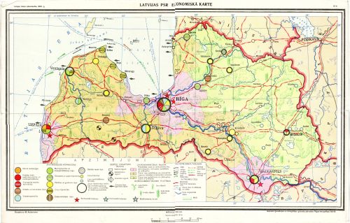
The Economical map of the LSSR
The Geographical Atlas of the Geography and Oceans. Committee of the USSR Geodesics and Cartography 1992
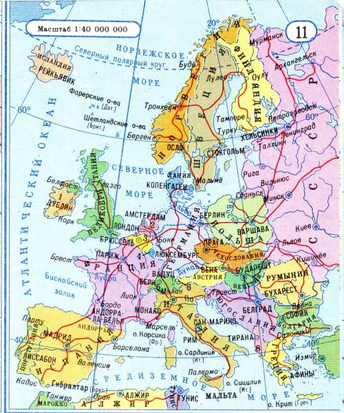
Soviet map published in 1992 showing USSR still intact, while Germany has united
 Latvian History